
The City of Mesquite is pleased to announce the publication of several web-based mapping applications. These mapping applications are the first map services the City has released to the public and are intended to make some of the City’s public information more readily available to the general public. The following is a description of each of the map applications currently available. A page has been created at http://maps.mesquitenv.gov to access all of the available map applications. More map services will be available in the future as needs are determined.
Mesquite Parcel Viewer provides the general public and other interested parties local government property tax and assessment information. The user can search for a parcel by address, parcel ID number or owner name. Information on the parcel appears in a pop up information window, with links to the county assessor’s website.
Mesquite Address Locator allows the user to search for an address, subdivision or street name. When an address is located, information pertaining to the address location and subdivision is given. Other features include aerial imagery and access to view Google Street View.

Virgin River Habitat Conservation Plan (VRHCP) Viewer shows areas of critical habitat for three protected species which live along the Virgin River. Clicking on each habitat gives some information about each species, as well as a link to the US Fish and Wildlife’s website.

Mesquite Land Use and Zoning Viewer displays the City of Mesquite’s zoning and land use areas. Searching by address, street, subdivision or parcel ID will provide information pertaining to zoning and land use.

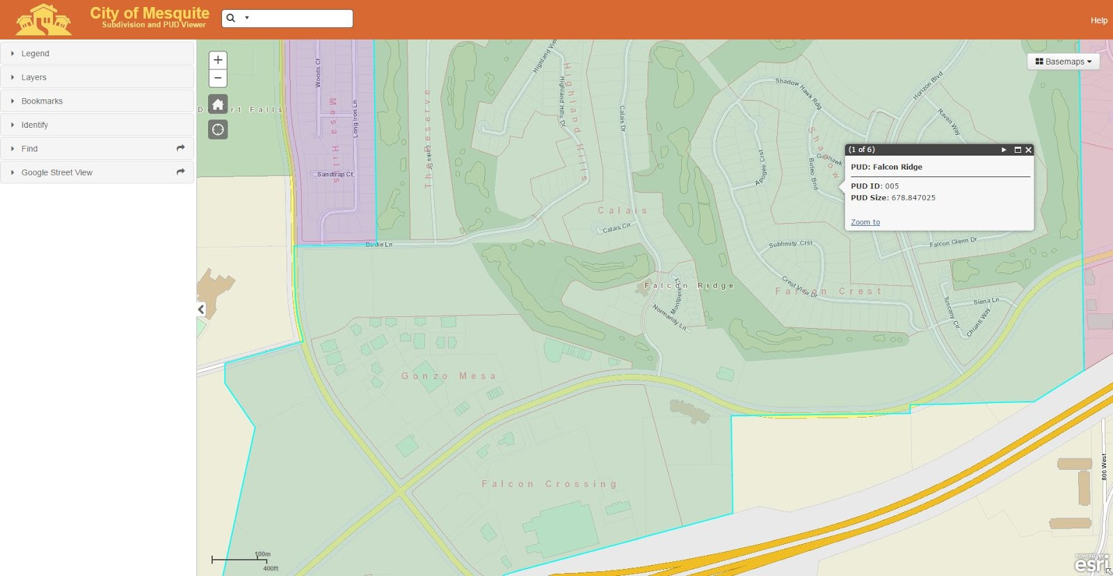
Mesquite Subdivision and PUD Viewer allows the user to view information concerning Subdivisions and Planned Unit Developments (PUD) within Mesquite. Search is possible by address, subdivision, or street name. When an address is located, information about the subdivision and PUD is given. Other features include aerial imagery and access to view Google Street View.
Mesquite Places of Interest is a web application designed for someone new in town looking to discover everything that Mesquite has to offer. Choose from a variety of topics to find a restaurant, hotel, golf course or public facility. Clicking on numbered points of interest will give more details, including hours and contact info.

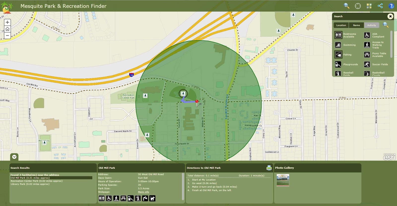
Mesquite Parks and Recreation Finder application helps citizens locate a park, trail or recreation facility and obtain information about recreation activities within Mesquite. A park can be located by entering an address or activity in the search box, or by using your mobile device’s current location. The park(s) or recreation area(s) will then be highlighted on the map and relevant information about available recreation activities presented to the user.


